For those who have been following T-Mobile ever since July 2013 (like yours truly), you can see the improvements they have done first-hand on their new maps.
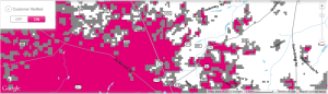
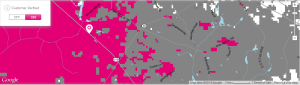
However, there is still work to be done, especially along US 78 east from the Williston Town Limits to Elko.
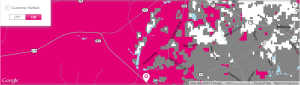
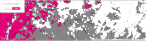
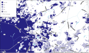
The maps below show that some 4G LTE is creeping into Barnwell County, but not in any incorporated community.
In a press conference on Monday, T-Mobile called this map the “next-gen” map. It shows near real-time customer experiences on the T-Mobile & MetroPCS networks based on “200 million actual customer usage data points every day”. The map also includes usage data from third party sources, including Inrix, a company which specializes in network analytics.
The new map includes:
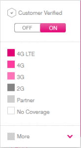
- “Customer-verified coverage” which is base on real-world customer usage. This results in a more transparent and accurate map which should show exactly where you can expect 4G LTE, 4G HSPA+, 3G or other coverage levels.
- “Verified Coverage” icon – This icon indicates areas where most of the coverage data is provided by T-Mobile customers reporting actual, real-life network experiences. T-Mobile hopes this will help add more confidence in the data on its coverage maps. This is not available on MetroPCS at this time.
- Regular updates – T-Mobile will update the data on both its map and MetroPCS’s map twice every month, so that it’s as up to data as you can expect. And will certainly be the most up to date coverage map offered by any US carrier.
- Lastly – Speed test data from trusted third party apps will show average download speeds from customer speed tests over the last 90 days.
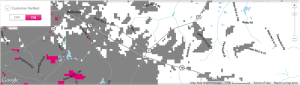
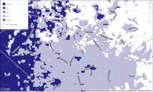
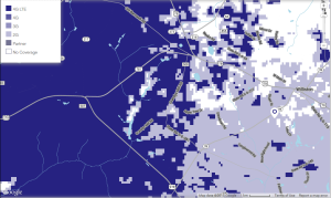
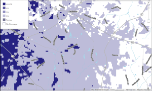
And just for the hell of it, here’s MetroPCS’s maps of Williston. The magenta has been replaced with a cobalt blue-like color for MetroPCS.
Call this taking the guesswork out of coverage.
T-Mobile Prepaid Coverage Map
MetroPCS Coverage Map


